Muncie at a Glance
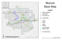
The base map highlights important natural amenities in Muncie like lakes, rivers, and parks. Institutional services are marked such as universities and emergency services. Infrastructural features of Muncie are shown like major roads and trails.
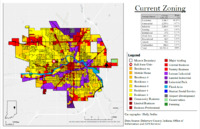
Zoning tells what uses are legally permitted on a parcel of land. Most land in Muncie, sixty percent, is zoned for a residential use. Both commercial and industrial comprise the second highest share of Muncie's land at approximately fifteen percent each.
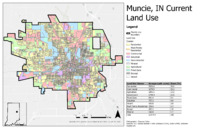
Land use shows what types of functions or acitivities take place within a parcel. The land use of a pacel can vary from what the land is classified under zoning. Just over a third of land in Muncie is used for residential while about a fifth is used for commerical.
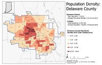
Delaware County currently has an average population density of 0.45 person/acre, which is 0.16 units higher than the Indiana state average. The densest part of Muncie, indicated in dark red, consists of the Northern half of Riverside, Ball State University, and Westridge.
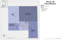
There are four school districts aside from Muncie Community Schools whose boundaries reach into the corporate limit of Muncie. Within Muncie's corporate limit there are 7 elementary schools, 3 middle schools, and 1 high school.
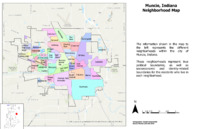
There are 52 neighborhoods that weave together to make the city of Muncie. Our site is in Thomas Park/Avondale.